Home

The Ancient World Mapping Center is an interdisciplinary research center at the University of North Carolina at Chapel Hill. ![]()
The Center promotes cartography, historical geography, and geographic information science (GIS) as essential disciplines within the field of ancient studies through innovative and collaborative research, teaching, and community-outreach.
The Center invites inquiries from scholars, authors, educators, students, and members of the public engaged in (or contemplating) projects related to cartography, historical geography, and GIS in the context of ancient studies. AWMC is committed to facilitating discussion, guidance, information exchange, collaboration, and access to cartographic and bibliographic resources in cooperation with such projects.
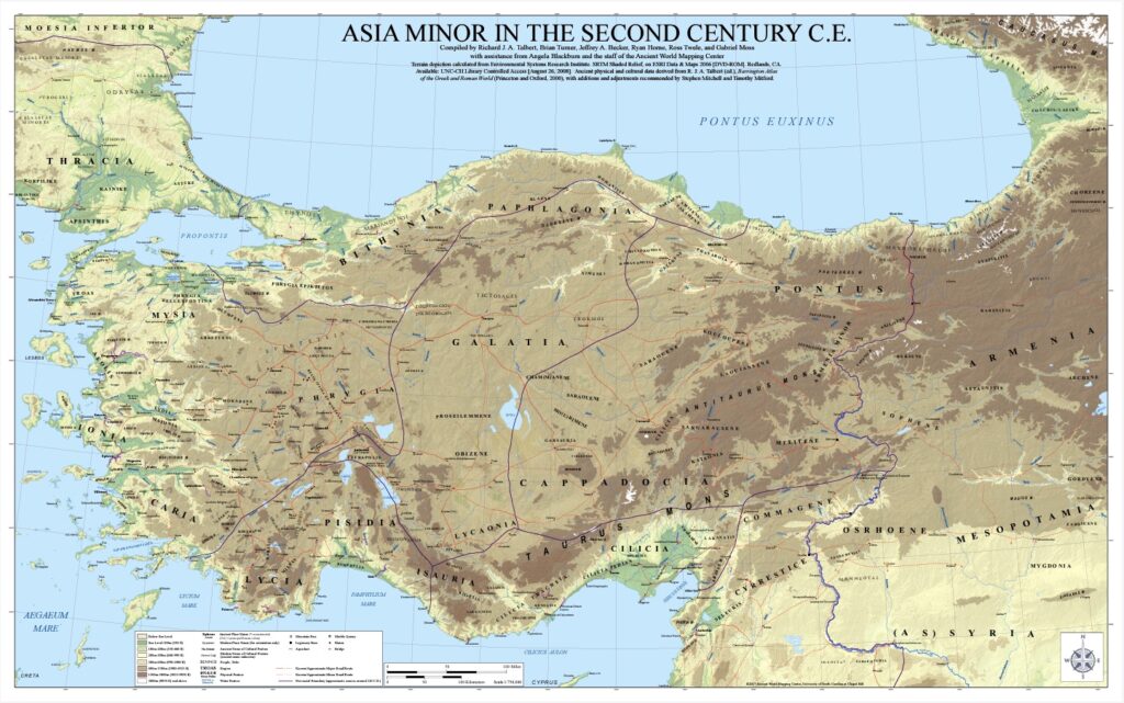
AWMC continues the work of the Classical Atlas Project that produced the landmark Barrington Atlas of the Greek and Roman World![]() (R. J. A. Talbert ed., 2000). With the publication of the print edition of the atlas in 2000, the Center began its work as an institute devoted not only to the continuation of the work of the atlas itself, but also to the advancement of a research agenda focused on the geography of the ancient Mediterranean world. The Center promotes its own independent research projects and collaborates with scholars to produce maps on specification for scholarly publication. In partnership with Pleiades
(R. J. A. Talbert ed., 2000). With the publication of the print edition of the atlas in 2000, the Center began its work as an institute devoted not only to the continuation of the work of the atlas itself, but also to the advancement of a research agenda focused on the geography of the ancient Mediterranean world. The Center promotes its own independent research projects and collaborates with scholars to produce maps on specification for scholarly publication. In partnership with Pleiades ![]() and other partners, AWMC continues to refine and expand the geographic data available for the ancient world.
and other partners, AWMC continues to refine and expand the geographic data available for the ancient world.
To ensure long-term funding of its mission, the Center secured a National Endowment for the Humanities Challenge Grant in 2001. Together with the Endowment itself, contributions were made by the Barrington, Gladys Krieble Delmas, Samuel H. Kress and Stavros S. Niarchos foundations, as well as by many individuals. The Center remains as grateful as ever for all this generous support, which is vital to maintaining its activity.