
Maps for Texts
Jump to:
- The Black Sea Region Described by Arrian around 130 C.E.
- Catholic and Donatist Bishoprics in North Africa, c. 411 CE
- Dionysius of Byzantium, Anaplous of the Bosporus
- Hierokles, Synekdemos
- Ptolemy, Table of Important Cities
- Strabo, Geography
- Theophanes, Journeys between Hermopolis and Antioch
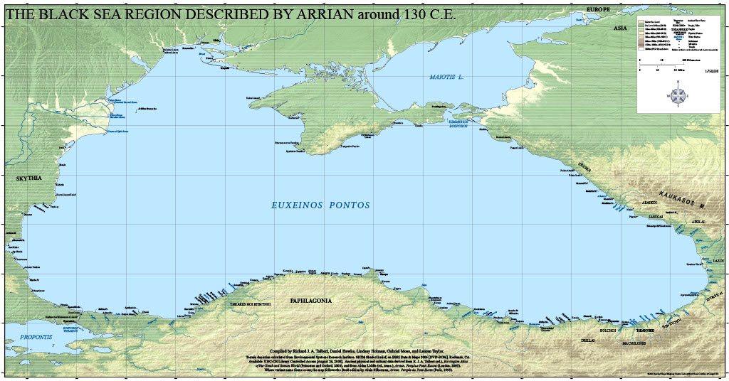
The Black Sea Region Described by Arrian around 130 C.E.
Arrian’s Periplus of the Black Sea describes the geography of this region during the reign of Hadrian. The Center’s wall map is accompanied by a directory and prints at 1 to 750:000 scale at a size of 86 by 45 inches. For access to this map, please email AWMC@unc.edu
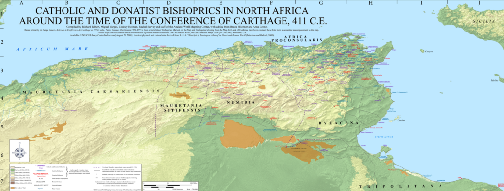
Catholic and Donatist Bishoprics in North Africa, c. 411 CE 
A wall map at 1 to 750,000 scale, depicting the Christian landscape of North Africa at the time of the Conference of Carthage. The map is accompanied by supporting data and documentation that encompass all known bishoprics of early 5th century North Africa (including those that cannot be securely located).
To access this map and its alt text, open the link and download the files from Dropbox.
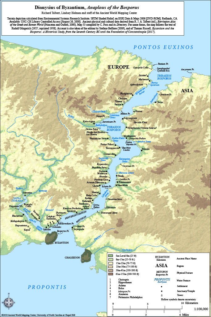
Dionysius of Byzantium, Anaplous of the Bosporus
The Center’s 1 to 100,000 scale map illustrates the Greek geographer Dionysius’ account of the Bosporus Strait and the city of Byzantium, and prints at a size of 12 by 18 inches.
To access this map and its alt text, open the link and download the files from Dropbox.
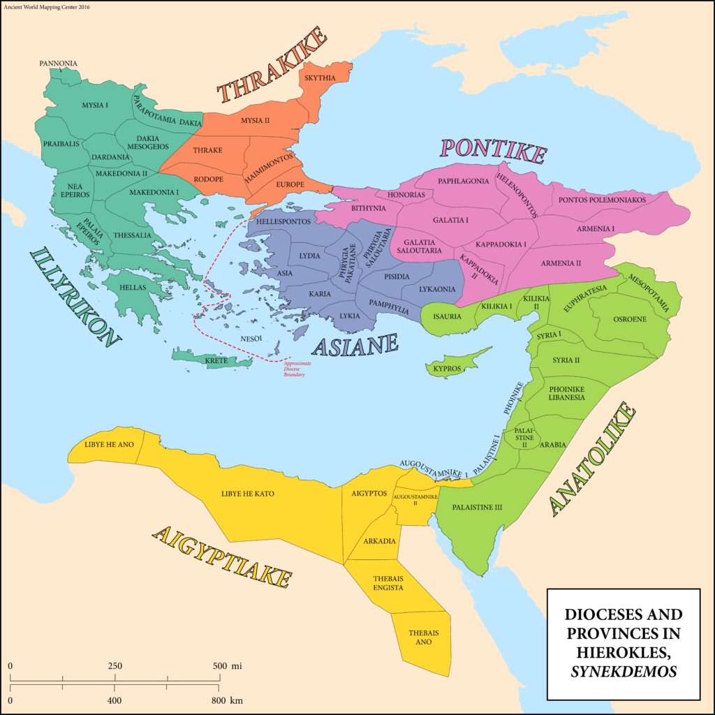
Hierokles, Synekdemos
Produced by the Byzantine geographer Hierokles in the early 6th century CE, the Synekdemos is among our most complete sources on the geography of the Eastern Roman Empire in the reign of Justinian. The Center’s interactive map depicts all cities from the Synekdemos that can be confidently located, as well as Justinianic provinces and dioceses. The application also includes a full database to accompany Hierokles’ text, including sites that cannot be identified with modern locations.
The Synekdemos web-map is currently undergoing maintenance to improve performance and restore the underlying map-tiles. The searchable database remains online, but the map viewer itself may not work as intended.
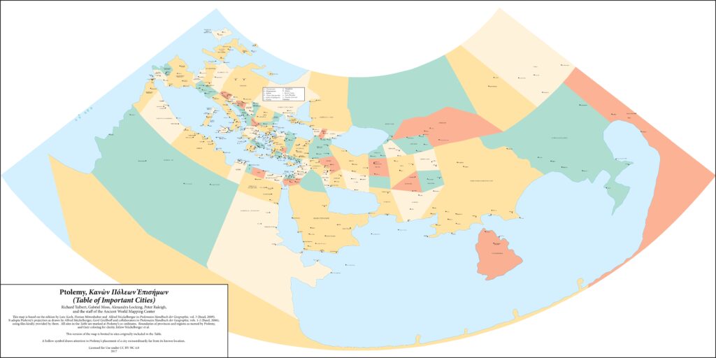
Ptolemy, Table of Important Cities
Claudius Ptolemy was one of the most influential mathematicians and scientists in the ancient Mediterranean world. His Geography is perhaps our fullest single source on Greco-Roman geographic knowledge and theory. 4 static maps depict the “Table of Important Cities,” a précis of the larger Geography, mapping these cities on both a modern basemap and on a reconstruction of the ancient world and Ptolemy himself envisioned it (provided courtesy of Lutz Koch, Florian Mittenhuber, and Alfred Stückelberger, editors of Ptolemaios Handbuch der Geographie).
To access this map and its alt text, open the link and download the files from Dropbox.
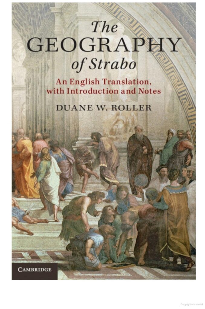
Strabo, Geography
[NOTE: The Strabo web-map is currently undergoing maintenance. The searchable database remains online, but the map viewer itself may not work as intended.]
The Center has created an interactive web map to accompany Duane Roller’s translation of Strabo’s Geography. The map is freely accessible online and plots all locatable geographic and cultural features in the text. Roller’s translation is available from Cambridge University Press. ![]()
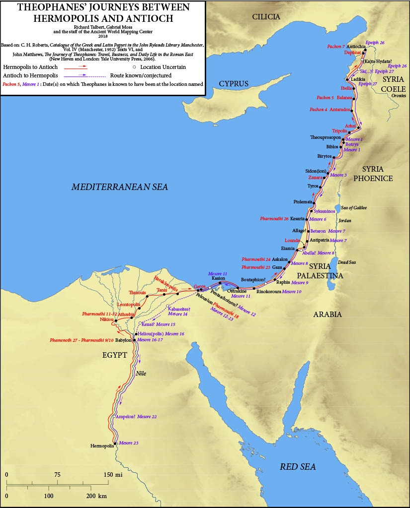
Theophanes, Journeys between Hermopolis and Antioch
The Center’s single, static map plots Theophanes’ journeys between Hermopolis and Antioch in the early fourth century CE, as recorded in the Rylands Papyri. The map is based on the edition by Colin Roberts (1952), and the translation by John Matthews, The Journey of Theophanes: Travel, Business, and Daily Life in the Roman East (2006).
To access this map and its alt text, open the link and download the files from Dropbox.