
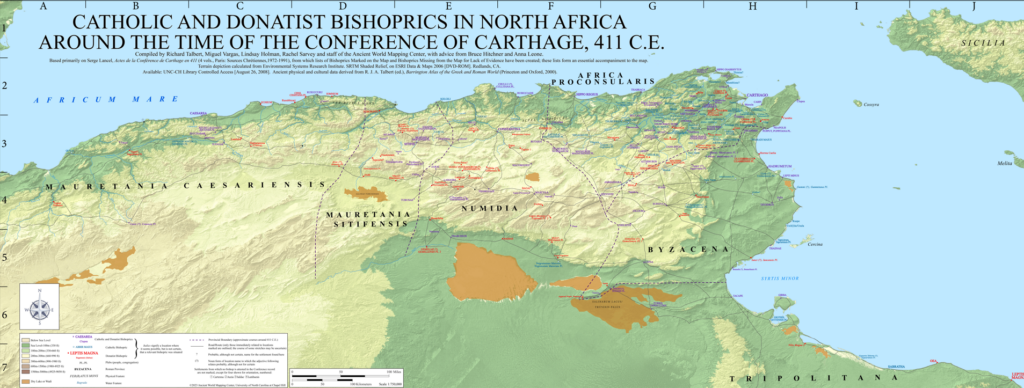
The Ancient World Mapping Center is excited to announce the release of the latest item in its Maps for Texts series: Catholic and Donatist Bishoprics in North Africa around the Time of the Conference of Carthage, 411 C.E. Drawing on Serge Lancel’s Actes de la Conférence de Carthage en 411 (1991) and subsequent research, the 1:750,000 scale map depicts the Christian landscape of North Africa c. 411 CE. It is accompanied by supporting data and documentation that encompass all known bishoprics of early 5th century North Africa (including those that cannot be securely located).
The map and accompanying materials were compiled by Richard Talbert, Miguel Vargas, Lindsay Holman, Rachel Sarvey, and the staff of the Ancient World Mapping Center. Bruce Hitchner and Anna Leone provided valuable advice. The map and materials may be freely used, with proper acknowledgment, for personal study and teaching. To inquire about licensing and other forms of reuse, please email awmc@unc.edu.
To access this maps, as well as metadata and alt text, open the link below and download the files from Dropbox.